Today machinery is being delivered with precision tools embedded into the systems from manufacturers. The industry is inevitably on a path towards progressive agriculture with precision farming tools improving accuracy and efficiency. With the increase in production inputs how can we make this technology pay?
John Deere’s Operation Center is the best platform for machine and agronomic analysis on the market at this time, and is the leader in seamless data flow. Before we can analyze data we have to know where to start collecting the data properly, and confirm that we feel confident with the analytics coming into the Operation Center.
Precision Boundary Creation
Accuracy of field boundaries is the first step in building a Precision Agriculture platform for your farming operation. These tools are available to be hand drawn within the “Land” tab on Operation Center, which can be found at www.myJohnDeere.com. With the increase to maximize acres owned and operated, the utilization of Precision Boundaries can give opportunities for higher accuracy in engaged acres for conservation programs, input planning, commodity contracts, and FSA documentation.
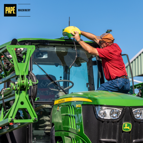
Precision Boundaries are best created with a UTV in the off season. A vehicle set up with a Starfire6000 Receiver and Generation 4 Monitor can document boundaries, guidance tracks, and flags. Bordering the fields during the off season allows the operator to be as accurate as necessary with the understanding that Section Control will utilize these specified boundaries throughout the season.
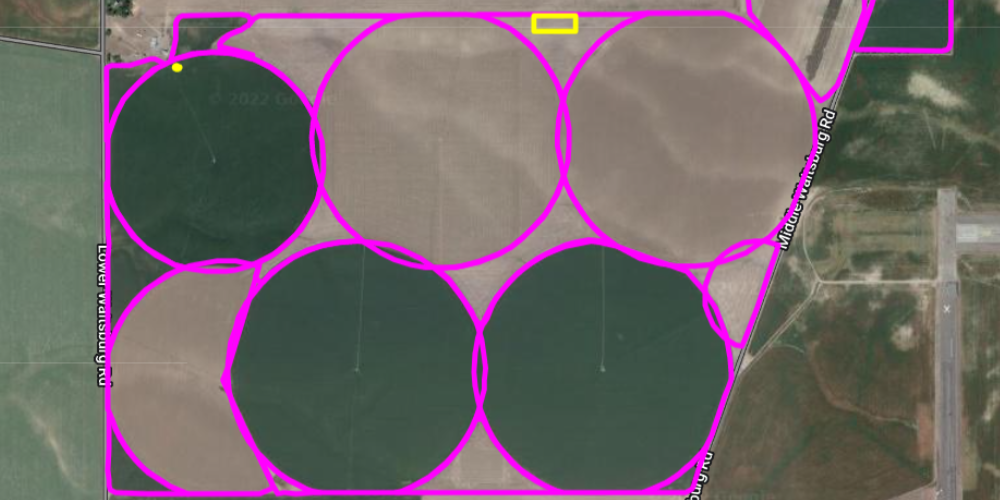
After collection of all the fields on the farm the next step is to export the shp file and import into John Deere Data Manager. Once imported, they will appear as pink borders on the “Map” page, then you can utilize the tools in “Land” to do any editing.
Value of Precision Boundaries
The additional time it takes to create these boundaries, guidance tracks, and flags can tell a grower more about their operation than initially expected. With FSA maps being the original form of acre documentation in the United States, many still utilize those satellite blocks created in the government systems. This often leads to inaccuracy in acres planted, seed rates applied, input shortages, and inaccurate program acreage.
A study conducted during the 2022 Season shows the results of inaccuracy in boundary management of high value crops in the Columbia Basin Region.
In this first example our grower began planting in the middle of April but did not finish until early May. After checking the fields for germination progress we found a total of 26 acres left unplanted of Seed Corn.


This breakout showed a potential loss of $46,000 in one season due to having unspecified boundaries in their guidance system. Over a 5 year span, this could result in a loss of over $230,000 to the grower due to the lack of Precision Technology adaptation. In this scenario, the commodity contract specified the distance left around the outside of the circle due to harvesting precautions and seed pollination within the Seed Corn. Knowing your plantable acres on every field gives the grower opportunities to leverage unplanted acreage for additional income or increased commodity prices due to the logistics of the contract.
Precision Irrigation Integration
With the increasing crisis of labor shortage in the agricultural sector it is common to see center pivot, lateral pivot, or swing tower extensions being put up in replacement of handline and wheel line irrigation in the Pacific Northwest.
The push to Precision Irrigation goes hand-in-hand with Precision Farming on your operation. This will require the use of a couple platforms but the tools optimized can help link the two systems. Considering the irrigation system metrics, weather conditions, nozzle ratings, and end-gun pressures can all play into Precision Boundaries when it comes to planting high-value crops.
In our second example while scouting in an irrigated Wheat Seed & Corn Seed crop we found 13 acres of overlap due to the lack of synchronization on the center pivot end guns.

A potential loss of almost $8,000 per circle due to overlap, which is a key piece of information to take into consideration when looking at annual operation inputs. Multiple years of overlap with pesticide, fertilizer, and water cannot only have cost implications but can also cause environmental concerns after long periods of times.


Agronomic Considerations
The push towards Precision Farming is a huge step for Agronomists all over the world to start collecting data in sectors of agriculture never previously available. With the opportunities to focus on Yield Maps, Variable Rate Fertilizing, and Satellite Imagery we can also draw conclusions based on previous activities performed per acre.
Concerns in irrigated agriculture with lack of precision technology engagement include
- Leaching of Pesticides and Fertilizers
- Dead Zones created by overapplication
- Erosion and Runoff on hillsides
- Weak Crop — Disease Development, Lodging, Maturation, Slow Harvest
Conclusion
Precision Agriculture will provide endless opportunities to increase productivity, as exemplified here in these two studies. Though we touched briefly on things to consider in irrigated farming, the opportunities behind adoption of Precision Agricultural Technology touches all spectrums of the industry in different ways.
If you’re interested in learning more about getting a utility vehicle set up for boundary creation, please reach out to your local Papé Machinery Agriculture & Turf Territory Manager for further information.


